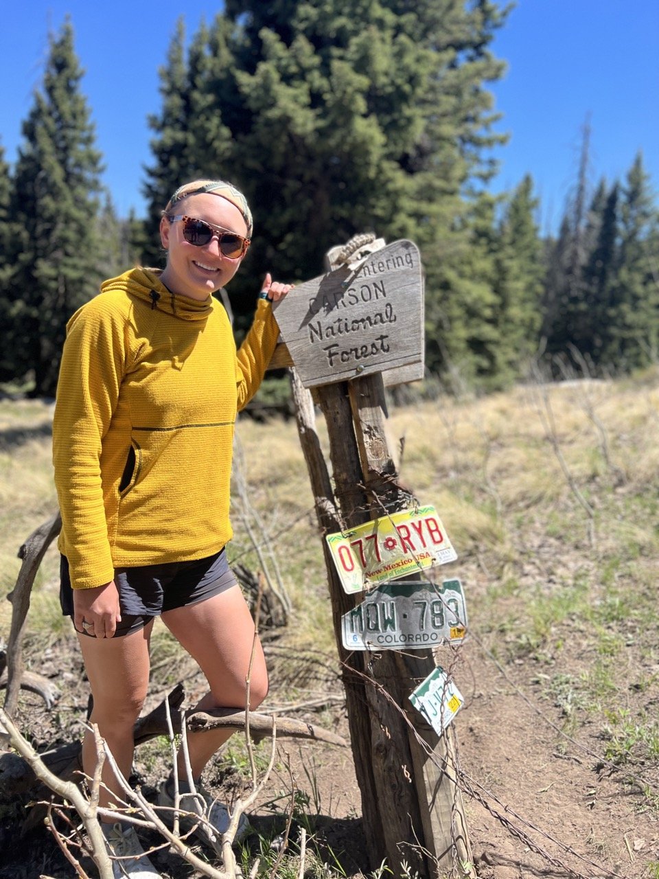
Comprehensive Continental Divide Trail Q&A: From a 2022 CDT Thru-Hiker

As we approach prime backpacking season and a new class of thru-hikers is ready to embark on America’s best long trails, I am acutely aware of the pre-hike jitters that often come in the weeks before a big adventure. A million questions begin to run through your head (or at least they do mine) and sometimes hearing from someone who’s been through it can be the insight you need to take a step back and just relax.
Because of that, I decided to answer some questions about what to expect on the Continental Divide Trail. I polled my Instagram and Youtube communities to see what they’re most pressing questions were about thru-hiking the Continental Divide Trail. They range from the ever-present dilemma of whether you should hike north or south, the best (and worst) resupply spots on the CDT, where to send boxes on the CDT, what CDT alternates you should take, how to deal with water sources on the CDT, what to do about bears on the CDT, comparing the CDT to the PCT and more!
These answers are based on my experiences thru-hiking the CDT northbound in 2022, so please keep in mind that the trail can and does change every year, and your experience (and literal mileage) may vary!
NOBO vs. SOBO on the CDT, FLIP FLOPPING, START DATES?
Should you hike the CDT northbound or southbound?
@drugstore_cowgirl “why would you ever hike nobo?!?
@onestepahead8 nobo or sobo?
While I hiked northbound, many agree that the CDT is inherently a southbound trail. What will be best for you, will depend greatly on factors, like the Colorado and Montana snowpacks, that are almost impossible to determine until March of each year. That timeframe doesn’t leave a ton of time to prepare for those hoping to hike northbound, ideally starting in April.
My answer to this question is very frustratingly, “it depends.”
The year I hiked happened to be a very frustrating year to hike southbound, which worked out well for us (leaving from the Mexican border in mid-April), and not so well for the people trying to leave the Canadian border in mid-June. The southbounders in 2022 encountered high snow in Montana (and a freak, late June snowstorm), LOTS of high water in the Bob Marshall Wilderness, bear closures in Glacier, a late monsoon season in Colorado, and flooding in the Gila River corridor. It made for a surprisingly challenging year.
Typically, hiking southbound requires a slightly faster clip, but results in better weather overall. Leaving from Glacier in mid-june (which with it’s relatively lower elevation is usually doable as far as snowpack), means you have roughly 3 months to get through Colorado before early winter storms start becoming a concern at higher elevations. Then, you can take as much time as you want hiking the remaining nearly 800 miles through New Mexico.
Hiking northbound in a given year typically means starting sometime in April, and making it all the way to the end in mid-September, before those same winter storms become a concern up north in the Glacier backcountry. This window can be challenging because it often means making your way through an early season Colorado snowpack. Our 2022 northbound timeline put us in the San Juan mountains in late May. It was extremely challenging and the snowpack was lower than normal. In an above average or even typical snow year, we may have had to flip.
There are options, though, such as taking lower elevation alternates (but I wouldn’t recommend them because you miss out on what is, in my opinion, one of the best sections of trail). I’d recommend a flip flop before I’d recommend the Creede Cutoff. But I’d recommend the Creede Cutoff WAY before I’d recommend cutting your hike short. So really, do whatever will keep you on trail.
All that said, I do think southbound is typically the more reasonable way to hike this trail. Usually you can navigate through Montana in reasonable snow conditions, will hit Colorado after the worst of Monsoon season (it typically peaks in the first week of August and slows down from there), and can use your well-earned thru-hiking legs to show those New Mexico road walks who’s boss. In 2024 especially, southbound will be a logical approach given the low snow in Montana (which could mean fires by the time northbounders arrive), and higher snow pack in Colorado (which will make the first couple hundred miles in Colorado challenging for northbounders).
My argument for a northbound hike would be in the event that Colorado has a lower than typical snow year. It would allow you to get New Mexico out of the way first, and get through Colorado before fire season hits.
What are the best flip flop options on the CDT?
@jacobfreshofftheskillet “common/best flip flop options?”
I can’t speak to flip flopping on the CDT from experience, but I can tell you what I may do in the future/ would make the most sense as a flip flop strategy to me.
If starting northbound from the New Mexico/Mexico border in April, I think it makes sense to hike all the way to the Colorado border. From there, depending when you arrive, it could make sense to flip north and hike southbound from Montana all the way back. It also might make sense to take a few weeks off before doing so. Either way, you may end up with less snow in northern Montana than in the San Juan mountains in Colorado, which would be the only reason to do this kind of flip flop.
If you are hiking southbound, I don’t really see any logical reasons for a flip flop.
Finally, some people will hike north to the New Mexico/Colorado border, then skip up to the Great Divide Basin and do some hiking there before hitting Montana or Colorado. This version of flip flopping seems unnecessarily logistically challenging and time consuming for my preferences.
Overall, I’d probably only really consider the first option (flipping north after hitting the Colorado border).
If you are hoping to flip flop because you’re worried you won’t make it to Canada in time, keep in mind that there are several alternates that can shorten your hiking distance in the northern part of the trail that may be a better option than flipping.
When should you start the CDT?
@kkthomps “how did you figure out your ideal start date?”
If you’re hiking northbound, I’d start the CDT in mid-April. If you’re hiking southbound, I’d start the CDT in mid-June.
A mid-April northbound start is early enough to beat at least some of the desert heat, without being so early that you’ll hit the San Juans in Colorado at a completely unreasonable time. If you start much earlier, you will likely arrive there in May, and I can say from experience that this is less than ideal. Start any later and you’ll get sweltering desert conditions that I would personally not want to deal with.
A mid-June southbound start date puts you late enough to (hopefully) avoid TOO much snow in Glacier and the Bob Marshall Wilderness, but not so late that you will be sprinting to get through the San Juans before winter hits. Start any later and you might get snow in late September in Colorado which is not ideal.
If you’re a little faster (or have never thru-hiked before) or a little slower you may want to add some buffer to these suggestions on either end.
ALTERNATES:
Which alternates should I take on the CDT?
@madelyn_meanders “most recommended alternate”

I did a YouTube video about my favorite alternates on the CDT if you’re interested in my subjective opinions. However, I think this ultimately depends on what you are hoping to get out of the trail. Sometimes, I needed a shortcut, so I took the shortest alternate possible to get between point A and point B. Sometimes, I needed scenery, so I took the long way to get my beat up feet off a road walk.
My favorite alternates include:
The Gila River Alternate — more people take this than the actual CDT. It’s one of the most gorgeous places I’ve ever backpacked.
The Narrows Rim Trail — this one gest you off the especially long road walk on the way into Grants, New Mexico. It’s also beautiful and rugged and requires some light route finding.
Cirque of the Towers — This is the most badass introduction to the Wind River Range you could hope for. Don’t let the rumors of blowdowns scare you away, they’re worth it.
Knapsack Col — Also in the Wind River Range, this requires extra time, effort, and route finding, but is 1000000000% worth every ounce of extra effort you put into it.
Anaconda Cutoff — This one will save you time toward the end of the trail and take you through the amazing town of Anaconda, Montana. It also contains wonderful sections of the Anaconda Pintler Wilderness.
Colorado 14ers — There are lots of opportunities for bonus miles and peaks along the CDT in Colorado.
The CDT has no shortage of options when it comes to alternates. There are always options that allow you to get out of the trail what you came there for. The only alternate I would currently advise against is the Creede Cutoff. The section of the San Juans you miss by taking the Creede Cutoff is simply TOO amazing to miss out on. If you happen to arrive to the San Juans at a time where conditions are too dangerous to continue and the Creede Cutoff is the only way you can continue hiking, of course you should keep hiking. BUT make sure you find a way to come back and do that section one day — it’s a highlight of the trail.
How do you figure out CDT Alternates?
@eltonjoncon “how do you figure out all the alternates? That always seems so overwhelming to me”
Figuring out CDT alternates looks a little bit different for every hiker. Personally, I use a combination of the alternates that are programmed into Far Out, Far Out comments suggesting different alternates, Jonathan Ley’s maps, and my own discretion.
Far Out Alternates:
For the alternates already on Far Out, it’s fairly easy to deduce what you are getting yourself into and use Far Out the same way you would on the official route. I often used these alternates if they were a bit shorter or offered more opportunity for water than the official route.
Far Out Comment Alternates:
As more thru-hikers tackle the CDT every year, there’s an increase in comments on Far Out on random junctions and waypoints that give instructions for DIY alternates (or indicating the beginning of a Jonathan Ley alternate). These alternates don’t have an official line to follow in Far Out, but between some good topo maps and well thought out comments from previous year’s thru-hikers, you can usually find your way just fine. I’ll follow these, again, if they promise more water, less miles, less misery, or more scenery.
Getting the Farout CDT Alts:
Download the FarOut app from the app store and purchase either the CDT maps or a FarOut subscription. Alts will be obvious once you are looking at each section.
Jonathan Ley Alternates:
Jonathan Ley has spent years hiking and mapping the CDT. His maps existed before any that I am aware of, created for the purpose of thru-hiking the trail. Over the years he has annotated many remarkable alternates that many thru-hikers say are the highlight of the trail. You can often find the start of these in the Far Out comments as well, but I recommend getting his maps for a more accurate picture.
Getting the Jonathan Ley maps:
Download the Avenza Maps App from the App store. Search for “Jonathan Ley” and download the map sets you’ll need for each section. The maps are available for free, but I encourage you to donate to Jonathan to thank him for all of his meticulous work. You can do so by sending money via PayPal to his email: jonathan@phlumf.com.
DIY Alternates:
I think the spirit of the CDT is a bit different from other long trails in that it encourages adaptations and alternates. If you see something up ahead that looks interesting and you think you can reasonably reconnect to the official route after visiting it, why not give it a shot? Go visit the things you’d like to visit and see the things you went out there to see. Learn how to read maps and make up your own routes. Have fun and get lost (as long as you can find your way back).
FOOD / RESUPPLY ON THE CDT?

What is the average resupply on the CDT?
@mlarmel “average food resupply”
I’d say the average resupply on the CDT is 5 days in between towns (a little bit longer than the AT or PCT). Like both trails, you occasionally have options to shorten your resupply or skip towns. But the CDT more often pushes the limits in between towns and has less options. There were very few times we only went 2-3 days between towns (which is common on the AT) and several times when we went 8-9 days between towns (rare on the AT). While the PCT has a few longer carries, I found they were more frequent on the CDT. Going 100+ miles in between towns was certainly not unheard of and almost a common experience on the CDT.
What was the longest food carry you did on the CDT?
@billprice6458 “I'm curious on how many days the longest food carry was for you between resupply.”
@camden_frankson “why is hiking 168 miles without going to an available resupply point a mistake?”
The longest food carry we did on the CDT was ~9 days (July 22-30) and 160 miles through the Wind River Range from Lander, Wyoming to Dubois, Wyoming. I believe this is the same stretch my friend Road Runner (@camden_frankson) is referencing with his question above. There is a resupply option in the middle of the Winds (Pinedale, Wyoming) which requires a 20+ mile off trail sidequest and potentially difficult hitch. We opted to try and make it all the way through without doing that and were relatively successful. We were hoping to make it through in 7 days and were delayed by some vicious storms and enticing alternates. Luckily, we were able to bum some extra food off of hikers bailing from the high route and made it through 9 days adequately fed.
What was the hardest resupply on the CDT? / Where should I send resupply boxes on the CDT?
@kim.outdoors “where was your hardest resupply?”
@nerdhaus_alpo “where on the CDT is it necessary to send boxes? “
Some of the trail towns on the CDT absolutely leave quite a bit to be desired by way of grocery stores and resupply options.
Here is where we sent boxes (and my thoughts on each):
NEW MEXICO:
Pie Town, New Mexico — There is virtually NO way to resupply here otherwise. If the toaster house is still in operation, I would send a box there over the post office so you don’t have to deal with post office hours.
Doc Campbell’s, New Mexico — Doc Campbell’s was pretty well stocked when we arrived and I think you could get away with not sending a box, however it’s pricey. I’ve also heard during big rushes/bubbles they can get a bit wiped out. We sent a box here and were happy with that decision.
Ghost Ranch — There is really no way to resupply here without hitching about an hour into Abiquiu, however you don’t necessarily have to resupply here, you could carry enough food to get from Cuba to Chama (about 60 miles).
COLORADO:
We didn’t send any resupply boxes in Colorado. Some people will send one to the Twin Lakes general store, however this seems unnecessary given the mileage between resupply locations. You could definitely supplement a resupply at the general store, however I probably wouldn’t want to do a full one there due to the price and selection.
WYOMING:
Riverside/Encampment — We did not send a box here, and managed okay, but I wish we had. The resupply is a small general store/gas station that didn’t have a super wide variety of options.
IDAHO/MONTANA:
Lima, Montana — Lima has a big gas station with the kind of food you can find in a gas station and that is your only resupply option. While you can certainly make it work, I recommend getting at least a supplemental box sent to Lima.
Leadore, Idaho — Leadore has a passable general store but it’s very expensive. I recommend at least a supplemental box.
East Glacier, Montana — East Glacier does have some grocery stores, but they require a bit of walking if you are staying at Looking Glass. You will likely already be sending yourself some logistical things for the end of trail here, so I’d recommend adding some food.
Out of all of these locations, I think the hardest/worst resupply would be Pie Town or Lima. In Pie Town you truly have NO options besides hitchhiking out of town. In Lima, you’re stuck with a giant gas station that is not catering toward thru-hikers (yet).
WATER:

Did you ever run out of water on the CDT?
@josephdroy “how close did you get to running out of water?”
I ran out of water on the way out of Grants, New Mexico. I got distracted by hiking straight out of town with friends and forgot to check where our first water source was. It turned out to be about 16 miles in on a hot afternoon. I left town with roughly 1.5 liters. Safe to say I was parched by the time we arrived at a cow trough on the Mt.Taylor alternate.
I also ran out of water one day in Colorado when I forgot to check again. You can get lulled into a false sense of safety in Colorado, but since you are often traveling atop the divide, this trail can be surprisingly dry. I only had to go about 5 miles without water that time.
Most of the time, I carried a generous amount of water because I was too afraid of becoming dehydrated.
How bad are the water sources on the CDT?
@nina.trayn “How rough are the water sources? (how to survive this as a water snob)

The water on the CDT is certainly not as nice as the water on the PCT (or I imagine the AT) where you can afford to be a little bit more picky with your sources and they are certainly much more frequent. However, as long as you pay attention and plan (and have adequate carrying capacity, I’d recommend 5 liters worth for New Mexico and the great divide basin and certain parts of Idaho) it’s survivable.
As far as being a water snob, you’re either going to have to take a lot of extra care when filtering or, to be frank, get over it. There will be nasty sources that you have to drink from, that’s part of the fun ;).
TRAIL TOWNS:
What is the best trail town on the CDT?
@nobostone “favorite trail town/hostel?”
@herbivore_hiker “what trail town can we simply NOT miss?!”
I LOVE TRAIL TOWNS. Towns are, in my opinion, one of the best reasons for hiking a trail. When else in my entire life would I have ever visited Lima, Montana (and had the best steak of my life) or Rawlins, Wyoming (and gotten the worst hangover of my life at the literal Hole In the Wall) or Reserve, New Mexico (and spent two days doing the absolute most with my trail fam)?!
CDT trail towns are a special breed because some of them don’t yet know about the trail. Each state has distinctly different vibes and honestly, it’s too hard for me to narrow things down too much, so I’ll give you a few of my favorite/can’t miss towns in each state.
New Mexico:
Pie Town, New Mexico — Despite a definite lack of resources, there’s something unique and quirky about Pie Town making it a can’t-miss on the CDT. You simply must go to the Toaster House and also have a slice of pie while you’re in the town. I imagine things will be very different at the toaster house without Anita and the trail community lost an absolute gem with her passing. Hopefully, the town will still hold some of it’s charm without her there.
Reserve, New Mexico — Reserve is an optional stop in the very long stretch between Doc Campbell’s and Pie Town. We stopped and had the best time meeting locals and hanging out.
Colorado:
Lake City, Colorado— This isn’t exactly an optional stop, but Lake City is charming, remote and one of the last little mountain towns in Colorado that hasn’t been overtaken by commercialization.
Leadville, Colorado — With the way towns start popping up left and right in central Colorado, some hikers might consider skipping Leadville, but I urge you to visit. It’s home to Melanzana, those cult-y fleeces every thru-hiker seems to have, an awesome hostel and some great food.
Honorable mentions in Colorado (I could write about many of these towns for hours as Colorado is my home state): Pagosa Springs, Salida, Twin Lakes, and Grand Lake.
Wyoming:
Lander, Wyoming: Lander is the gateway to the Wind River Range and an awesome visit in Wyoming. It has everything you could need and some great outfitters and thai food.
Idaho/Montana:
Leadore, Idaho — Had to give Idaho at least one mention. We didn’t stop in many Idaho towns, but The Mustang Inn made our stay in Leadore. I also kind of love towns that are so small everything HAS to be walking distance.
Lima, Montana — Had the absolute BEST steak of my life at The Peat Saloon and Steakhouse. There’s only one place to stay and one grocery store. This kind of town is what thru-hiking is all about.
Anaconda, Montana — Pintlers Portal is one of the best hostels I’ve ever been to.
Augusta — Again, this is one of those towns that just embodies thru-hiking for me. It’s so small that everything has to be in walking distance, and the locals know why you’re there. It’s also the only stop in a very long stretch of the Bob Marshall Wilderness. Hard to get to, but worth the effort.
Darby — Honorable mention because of it being home to the Yellowstone Ranch (from the TV show) and the Montana Cafe (excellent breakfast, gigantic pancakes).
PREPARATION:
How to prepare for this year’s snow pack in Colorado on the CDT?

@nobostone how the colorado snow pack is this year vs. other years?
According to postholer, the Colorado snowpack on the CDT is currently below average (compared to 2003-2024). It’s also lower than it was in 2022, the year that I hiked. I think if you are hiking northbound and hit the San Juans in early June, it will be doable, although you’ll probably want an ice axe and spikes.
For context, we hit the San Juans in late May in a higher snow year and did not need snow shoes, but definitely needed an ice axe and micro spikes.
The San Juans are sneakier than a trail like the PCT, because the CDT tries to stay atop the divide as much as possible, rather than how the PCT does a pass and valley route. On the PCT, you can anticipate that the passes will have snow you may need to worry bout, on the CDT it’s not that straightforward. North facing and north east facing slopes with steep aspects are going to pose the biggest issues and those are just randomly placed throughout your day.
Besides bringing the right tools (ice axe and microspikes), and knowing how to use them, I’d prepare by having topo maps downloaded and not being afraid to be creative to avoid steep snowy areas.
How long should a first-time thru-hiker prepare/train for the CDT?
@eliseiswright “how long do you think a first-time thru-hiker should prepare /train before attempting this?
This is ultimately super dependent on each individual. I’d recommend preparing and training as much as you possibly can, and be aware that it’s a very physically challenging adventure. If you can, start a little bit earlier so you can go a bit slower in the desert/New Mexico and get your trail legs. If you are starting southbound, I’d recommend getting a lot of training miles in with your backpack on. If you’re an active person, I’d probably try to start training specifically for thru-hiking 5-6 months out. But ultimately, the more time you get in the better.
What is the hardest part of the CDT logistically?
@kkthomps “hardest part, logistically?
I think the hardest part of the CDT, logistically speaking, is probably following the trail (in certain sections). Because it’s so new, there is a high need for trail maintenance in certain sections and it will disappear altogether. I never really felt truly lost, It’s more annoying than anything, but it can certainly cause a lot of frustration.
Getting to the southern terminus of the CDT is also certainly a logistical challenge. It’s a long drive down a very rough dirt road, and the closest town is Lordsburg, New Mexico, which isn’t exactly a hub of activity. I’d highly recommend signing up for the CDTC’s shuttle to get there. They know what they’re doing and have the proper vehicles to get you there, plus you get to start with hiking buddies.
GEAR:
In case you’re curious, here’s my full CDT gear list.

What backpacking gear would you have changed on the CDT?
@the_history_of_mountains “one thing you wish you had brought or left behind”
I wish I had left behind one of the sleeping pads I carried. After adopting a blow up pad, I had a hard time leaving behind my foam pad. I should have kept the blow up pad and downgraded to a shorter or thinner foam pad for daytime naps.
I wish I had brought an Ursack. I was resistant to the idea at first because of the extra weight and cost, but hanging your food every night gets super annoying and tiresome, especially when you’re worn out from hiking 30 miles. Also, the trees out west aren’t always easy to find good branches on, so you have to do a two tree hang or walk around looking for a good branch for ages, OR risk doing a shoddy bear hang. An Ursack would have made some of my nights a lot easier.
One thing I was thrilled that I brought was my sun umbrella. Especially in New Mexico.
What was your pack weight on the CDT?
@janieobutler “pack weight!”
My pack base weight on the CDT was about 13 pounds, mostly due to my camera gear. Without my camera gear I think my base weight would have been right around 10 pounds.
MOTIVATION:
What are the most common reasons people quit the CDT and how do you overcome them?
@dillonjames07 “top reasons why people quit and how to overcome them”
This is purely speculation, but I think most people probably quit the CDT due to injury. Most people come out there with a decent amount of experience under their belts, and I think things out of their control (for the most part), like injuries, are typically what send people packing.
You can prevent injuries on the CDT with proper training, wearing the right shoes, and lightening your pack weight.
I think people also quit the CDT because it can be pretty miserable at times. The CDT just takes the brutality up another level in every regard, so if you leave for a thru-hike to enjoy it, you might not always be having a great time. Combine that with the fact that there are less hikers on the CDT, I think morale can take a toll. In the moments where I was especially miserable, it was important to remember why I came out there in the first place. For me, it was simply to prove to myself that I could. If I quit, that would have defeated the whole purpose. I’m also very stubborn and competitive, which helped.
How did you stay motivated on the CDT?
@k80.trail “what did you tell yourself when you wanted to stop/you were having a bad day?”
This relates to the previous question, but when I was having a bad day, I reminded myself that everything is temporary. No matter what the miserable thing was that day, it would eventually end.
In small moments, I would also remind myself that I can pretty much do anything for 1 mile (or half a mile, or whatever the distance was I needed to get through). Usually, the super miserable thing I was going through in that exact moment didn’t last longer than that.
Finally, I constantly tired to remember how much tougher I was getting as a result of the misery. There were so many days that just flat out sucked, and I kept saying to myself, “just think how much more you’ll be able to tolerate after going through this.”
What was your worst day on the CDT? And how did you learn from it?
@carlosmadden448 “Wondering what your absolute worst day on trail was. Why did it happen, how did it happen and what did you learn moving forward from it”
To be honest, there were a lot of pretty hard days on the CDT. It’s a really hard trail, and there were more than a few days where I contemplated quitting.
One day that sticks out was a day in the Great Divide Basin where I’m pretty sure I was dealing with heat illness or some sort of waterborne illness. I’d had diarreha for a few days in a row (and in the basin there is nowhere to do that privately), and I felt TERRIBLE. I was nauseous and super hot and really low on energy. But we were also trying to get through the basin quickly because it was flat, so we were still pushing 30s. I remember I got to one of the very few water sources in the basin, it was a reservoir and I thought to myself that if a car came by and stopped and asked if I wanted a ride, I would get in.
Funny enough, a car did come by, but I didn’t ask to get in and they didn’t ask if I wanted to. It was in that moment that I realized I’m probably just too stubborn to quit, even when I’m miserable. I’m also really glad that I didn’t looking back.
I think I learned that my stubbornness will take me very far if I let it, and also it reinforced the “everything is temporary” mindset. We eventually got through the basin, and were rewarded with the Wind River Range. What the CDT offers in brutality, it makes up for in beauty. You earn every ounce of enjoyment you get on that trail.
How do you get the most out of the CDT?
@maude.plltr “how to have the best time and enjoy it to the fullest, I’m starting the CDT in April!”
Take the alternates! Stop in the trail towns! Make sure you’re in shape! Other than that, it’s largely out of your control. Embrace the fact that you can do nothing bout how much certain days will suck and try to laugh at how bad it gets (because it will get bad). Some of my favorite moments on the CDT were when things were the crappiest and then it started hailing, because how can you not laugh at that?!
COMPARING THE CDT TO THE PCT:

What was the desert like on the CDT vs the PCT?
@danielle_0880 “sun/desert intensity on the CDT vs. PCT”
I found the sun and desert to be a lot more intense on the CDT. The CDT follows more of a desert floor, especially for the first 100 miles, than the PCT. Think more sand, less trees, and less water. I found the desert to be a lot hotter on the CDT, even though I hiked through in April on the CDT and May on the PCT (it is worth noting I had an exceptionally wet year on the PCT, which could have led to cooler conditions).
You also have a lot more sun exposure on the CDT. The average elevation of the trail in Colorado is over 10,000 feet, which means you are way more exposed to the sun’s UV rays.
What are the main differences between the PCT and CDT?
@__jenni_emilia__ “mainn differences between the PCT and CDT”
I could probably write an entire blog on just this so, to summarize:
The CDT is harder logistically, physically, and mentally.
The CDT has more remote sections more often.
The CDT has less people.
The CDT permits are easier to get (from a competitive standpoint, but logistically you need to do more work).
The people in CDT trail towns are less likely to know what you’re doing (but awareness is spreading).
The CDT has harsher weather (more storms, more sun).
The CDT is higher in elevation for longer.
The CDT tread is a lot tougher a lot of the time (you will start to understand why people rave about the CDT being graded for horses).
The CDT has more sections where trail is harder to follow.
COMMUNITY:

Three hikers filtering water in the Bob Marshall Wilderness (part of the class of ‘22 affectionately coined “mob in the bob”).
Was there community on the CDT? / What is the culture like on the CDT?
@peninaonthego “is there community on the CDT or was it very solitary?”
@mattinthehat55 “how busy was it? Seems like it’s growing every year”
@kkthomps “what was the trail culture like in comparison to the PCT/AT?”
There is certainly community on the CDT and thanks to the efforts of trail towns and the CDTC, it’s growing every year. I happened to be in the 2022 thru-hiking bubble, which anecdotally according to many trail towns, was about twice the size of any bubble they’d ever seen before. That bubble felt similar to being in the last group of thru-hikers on the PCT in 2019. So, a CDT bubble felt like a more popular trail’s stragglers.
We were able to find community on the CDT and really enjoyed it, without feeling like camp sites and trail towns were filled to the brim or overcrowded with thru-hikers.
If you are looking for a social trail, I wouldn’t recommend the CDT. We talked to hikers who were only several days ahead of us for most of the trail and had a completely different, much more solitary experience. However, if you are hoping for a social experience on the CDT, it’s possible you will get it.
Some trail towns are very in tune with CDT thru-hikers and very aware of the trail, while others aren’t at all. I suspect as the trail continues to grow, so will the (already existing) community around it.
Trail magic on the CDT was almost nonexistent. Hitches were harder in some of the smaller towns where the CDT isn’t very well known, or is a long way from the town itself.
NAVIGATION:
What navigation apps did you use on the CDT?
@the_real_moxie “is guthook “IT” for the CDT like it is for the AT? Other guidebooks, etc.?
I would say guthook aka Far Out is still “IT” for the CDT, however there is and should be a lot more use of supplemental maps. In addition to Jonathan Ley’s maps (which I mentioned already), I liked having another navigation app (like gaia) to download and use topo maps.
BEARS:

A black bear spotted in Montana on the CDT.
How did you deal with bears on the CDT?:
@erickjuarezjr “grizzly bears…wtf man”
@blreddish @what was your strategy for updating your bear safety when you got into grizzly country?”
I ALWAYS carried bear spray in grizzly country and kept it completely accessible on the hip belt of my fanny pack.
We added a dinner break to our day and usually ate dinner about a mile before camp (compared to non-grizz country where we typically eat at camp). If we didn’t have time to do this or ended up camping earlier than we thought, we would walk far away from camp to eat.
We hung our food (and smellables) every single night.
I tried not to night hike alone.
I would periodically yell out or bang my trekking poles together, especially when hiking at down or dusk, or in an area where I saw a lot of evidence of bears.
As I mentioned before, I wish I had brought an Ursak and that’s something I’ll do in the future. However, I’d probably still hang the Ursack as often as possible, especially on the CDT where you could be several days away from your next resupply. If a bear gets to an Ursack, your food can still end up smashed and inedible even if the bear didn’t get to walk away with it.
Eventually, you get used to all the bear related precautions and it’s not as bad as I’m making it seem.
How many bears did you see on the CDT?
@lemon_ally “how many bears did you see and how did they behave?”
I saw 4 bears that I can remember on the CDT. There was one HUGE black bear in Colorado that ran away from me immediately, the butt of a bear just outside of Yellowstone that also ran away immediately, another indiscriminate bear butt somewhere in Montana that also ran away before I could get a good look to identify more than, “bear”, and a small black bear on a road walk in Montana that was not scared of me at all. It was quite a ways ahead on a gravel road walk, but every time I yelled at it, it just turned around to look at me. So I kept my distance and stopped yelling until it meandered into the woods.
Josh saw a grizzly mom and cub in Glacier during our last night in the park right by our final campsite. Luckily, he gave them a wide berth and there were rangers with horses at camp that night. Those two were pretty busy digging up ground squirrels and didn’t seem to take any interest in our camp, but I was extra careful making sure I got ALL my smellables out of the tent that night.
CONCLUSION:
I hope this helps any prospective CDT thru-hikers. If you have more questions about any given topic, please feel free to leave a comment and I’ll do my best to answer. Of course, every year on any given trail is going to be a bit different and your experience may vary greatly from mine, but I hope sharing what I experienced helps you prepare even a little bit for the adventure of a lifetime. The CDT is as magical as it is brutal, and if you get to spend even a fraction of time on a fraction of this trail, you are one lucky human being.